Maps
🔗Boston Area, 1775
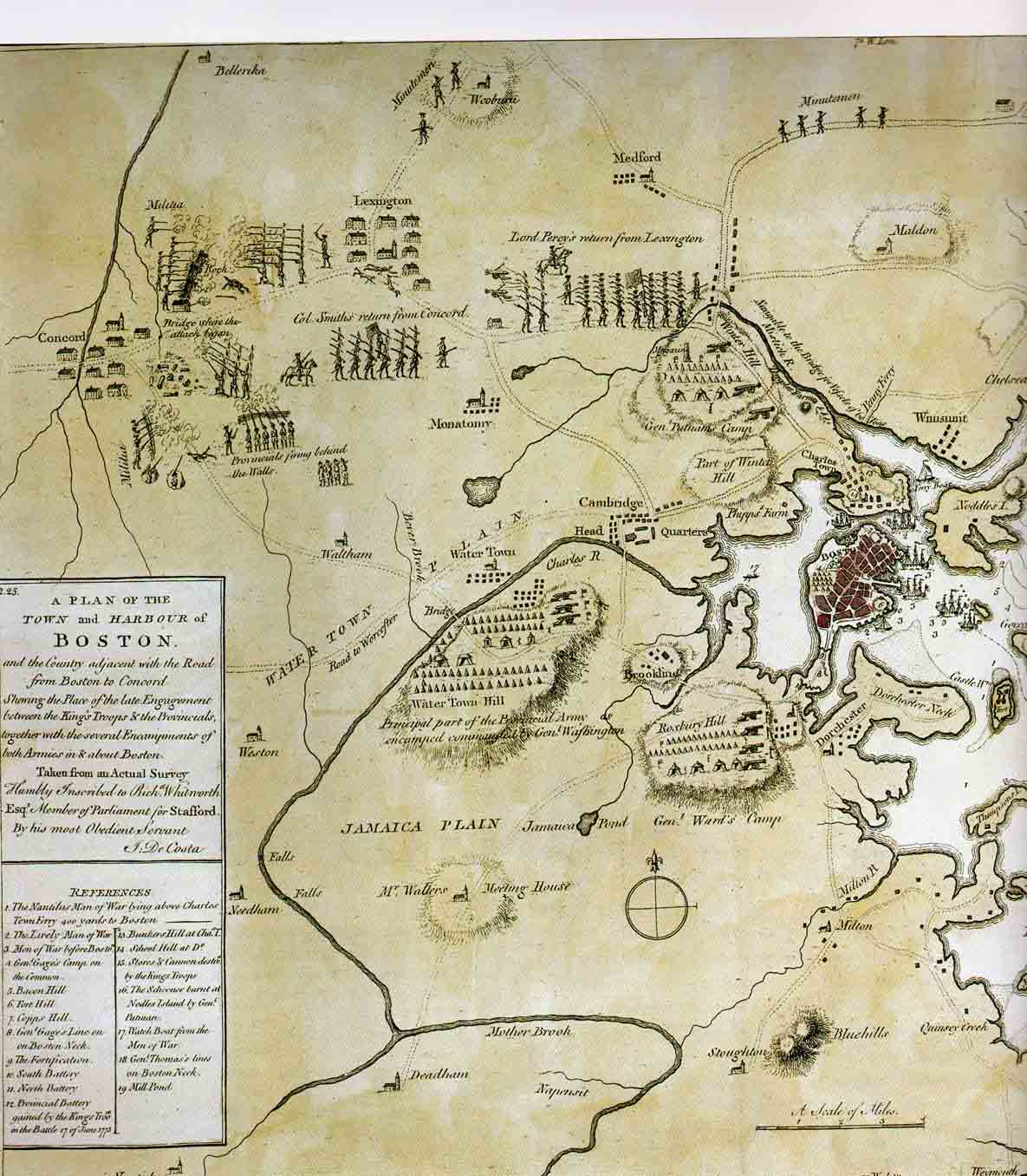
Map of the Boston area, including the road to Lexington, by John De Costa, London, 1775.
This was the first printed map to show American militia attacking British regulars, and it had an important psychological effect in England.
🔗Maps of The Ride
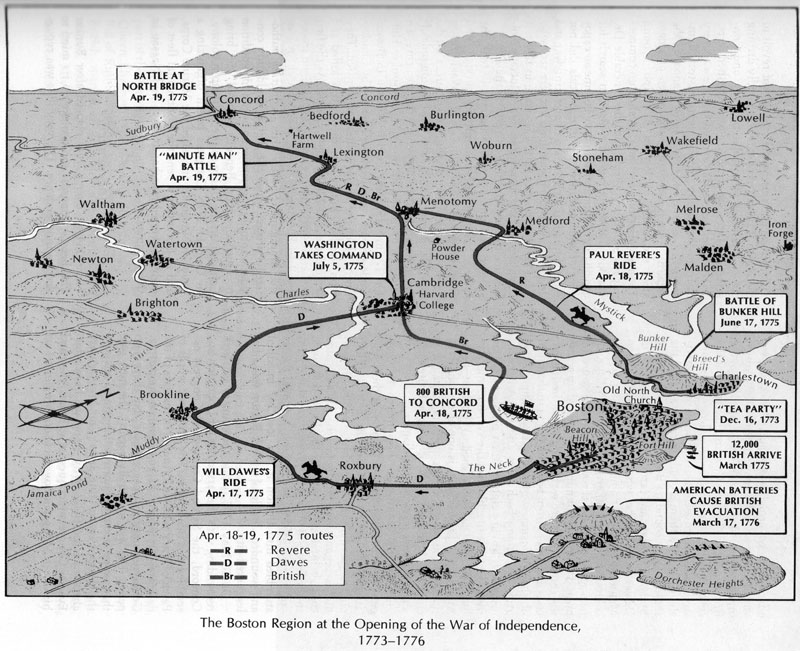
🔗1) Dawes-Revere Routes from Boston to Lexington
Map: The Boston Region of the American Republic (p.77) from "Concise History of the American Republic" edited by Morison, Commager & Leuchtenburg (1977).
By permission of Oxford University Press.
(Note that the date, April 17, on the marker for William Dawes' route is incorrect. It was April 18, 1775.)
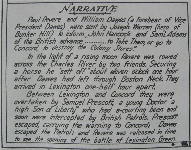
🔗2) Fagan Map, 1929
Map showing the rides of Paul Revere, Wm Dawes, and Dr. Prescott, April 18-19, 1775, James O. Fagan, 1929.
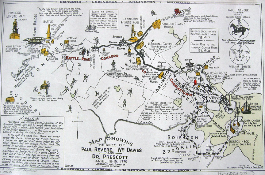
Narrative on Fagan map:
Fagan map information on the ride:
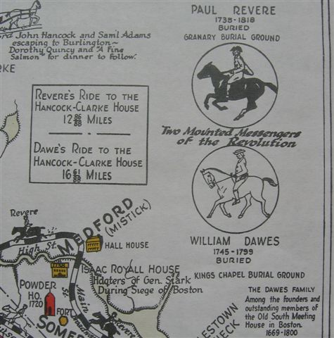
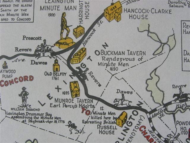
Detail, Fagan map:
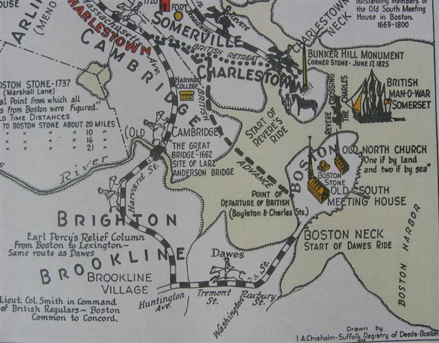
Detail of Fagan map: